Field forecasts
Current conditions, hourly detail, and a 35-day outlook at each saved field.
See forecastAgricultural weather Field by field.
FieldCast brings field-level forecasts, operating conditions, crop progress, and weather maps into one clear workspace—so the next decision starts with your acres.
One agricultural weather workspace
FieldCast combines the forecast with field boundaries, crop timing, and practical constraints. Every view is built to move from conditions to a clearer field plan.
Current conditions, hourly detail, and a 35-day outlook at each saved field.
See forecastCompare planting, spraying, fertilizer, tillage, harvest, and plant stress. Disease, soil erosion, and corn nitrogen tools are coming soon.
See conditionsRadar, precipitation, soil moisture, temperature, wind, drought, and field overlays.
See mapsFollow weather patterns, growth stages, growing-season totals, and 30-year context.
See trendsForecast
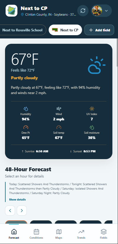
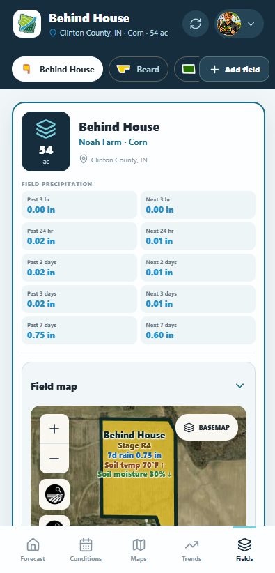
Move beyond the nearest town. FieldCast shows current conditions, soil temperature and moisture, wind, rain, and a 48-hour forecast for the field you are working.
Field Conditions
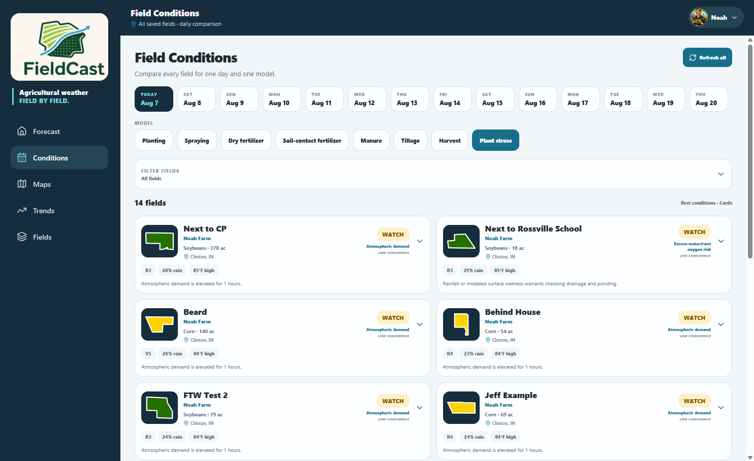
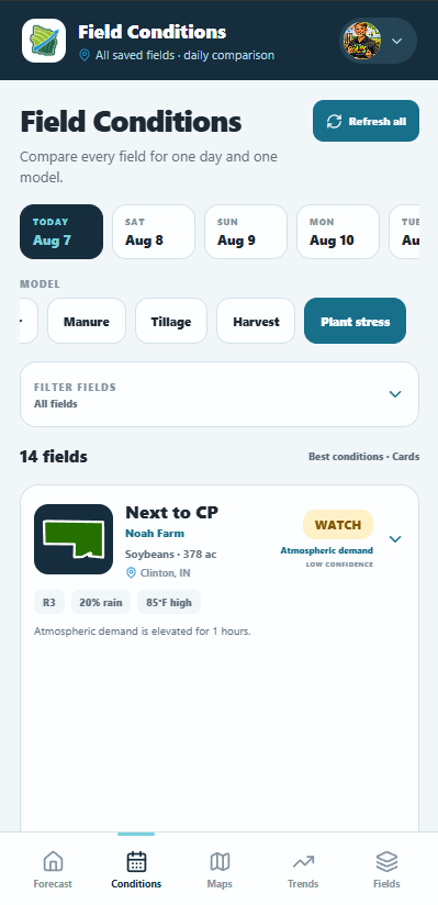
Choose a day and an operation, then sort the farm by the best or most limiting conditions. Scores show their weather and crop-stage drivers.
Weather Maps
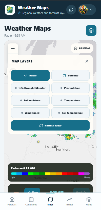
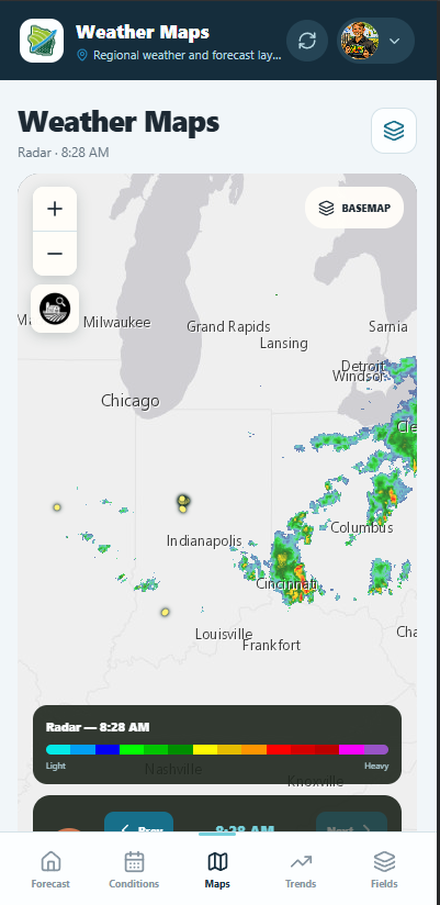
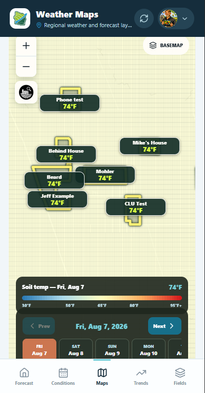
Move between radar and forecast layers while keeping saved fields visible. Follow regional weather, inspect field values, and step through upcoming conditions.
Trends + crop progress
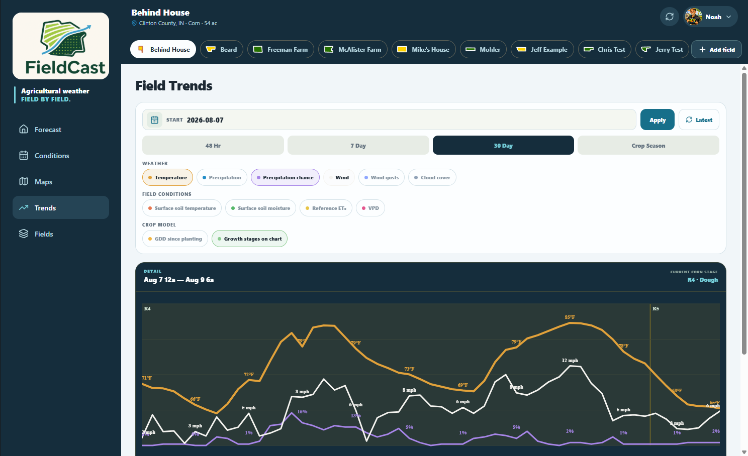
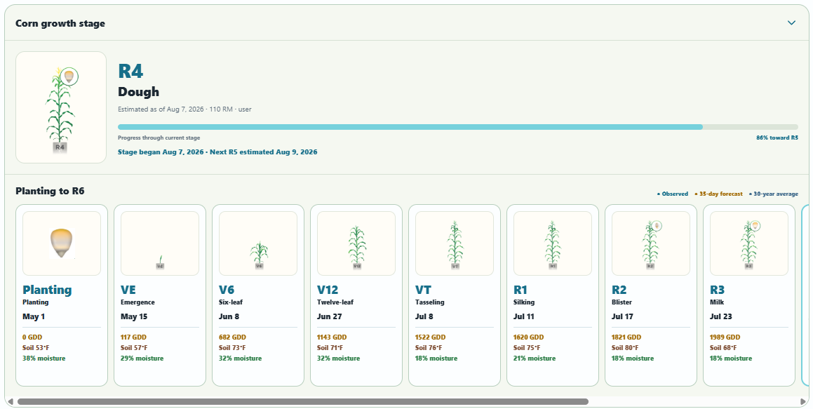
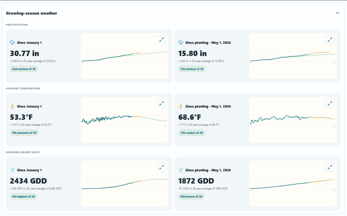
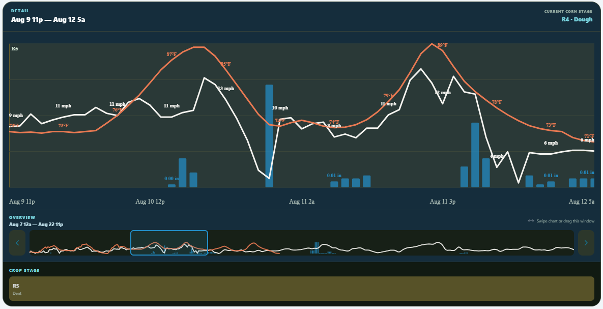
Explore 48-hour, 7-day, 30-day, and crop-season views alongside growth stages, observed weather, forecast weather, and 30-year averages.
Field calendar + weather summaries
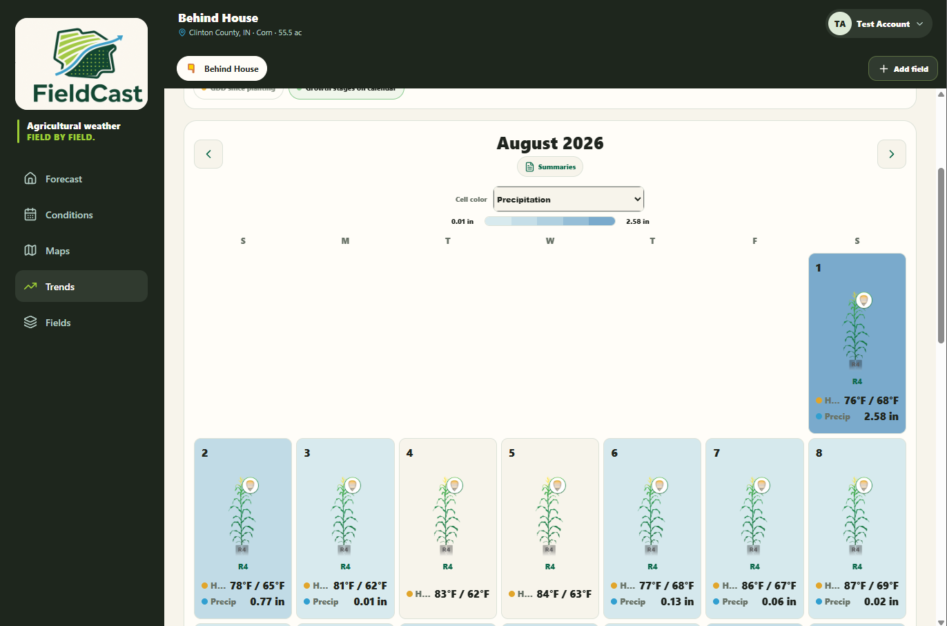
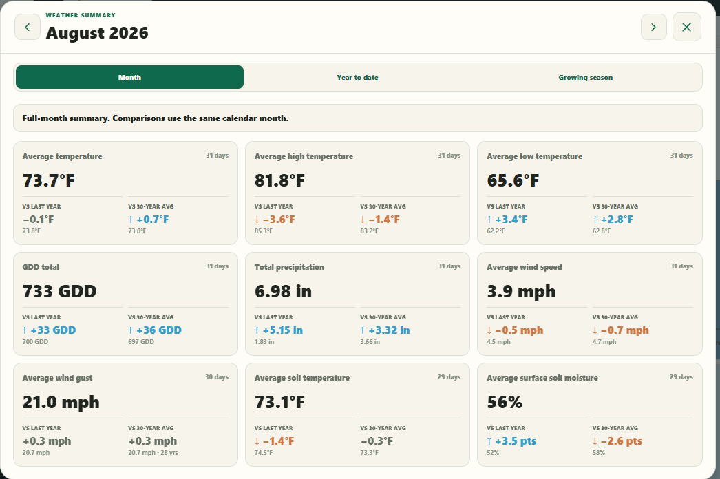
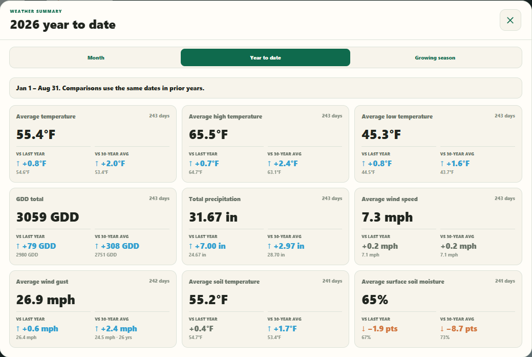
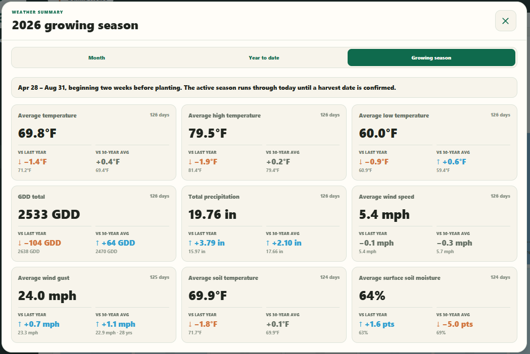
The FieldCast calendar brings daily weather, crop development, and field context into one continuous view. Move from an individual day to a complete month, year-to-date totals, or the active growing season without leaving the field.
Your acres, organized
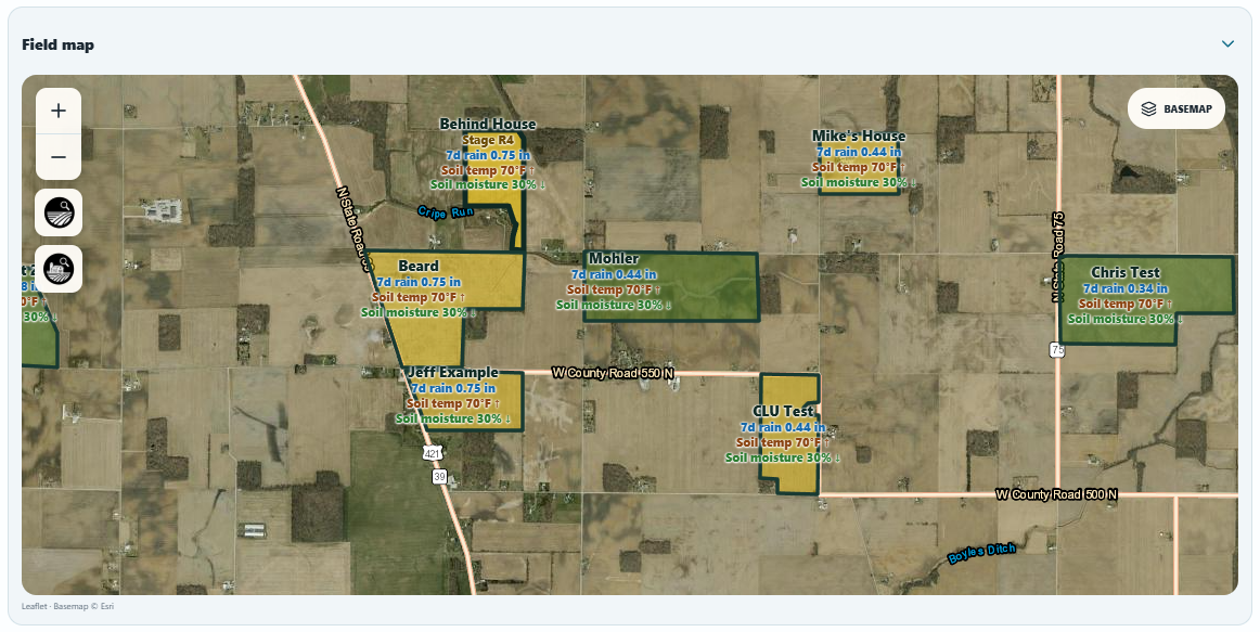
Save boundaries, crops, acres, and planting details. Every forecast, map, trend, and field-condition view stays connected to the same field record.
Create your first fieldDaily + weekly email summaries
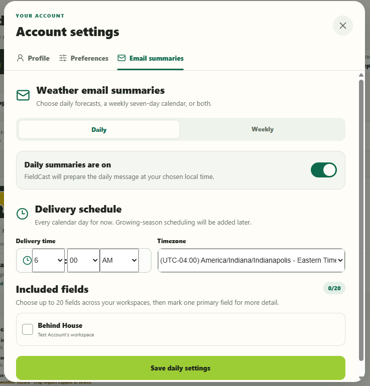
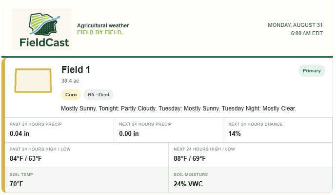
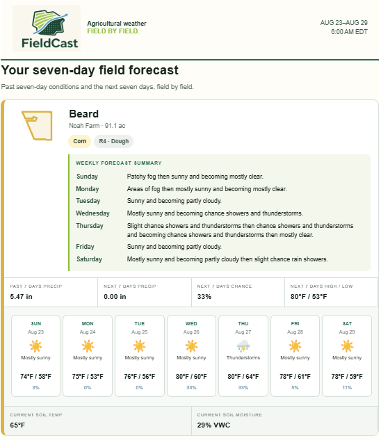
FieldCast can bring the forecast to your inbox on the schedule you choose. Select the fields that matter, mark a primary field for added detail, and set a local delivery time that fits the way your day begins.
Wherever the work takes you
Use FieldCast on the web now. Native iOS and Android releases are being prepared.
Why I built FieldCast
I’ve spent my career working at the intersection of agronomy, agricultural data, mapping, and practical field decisions. Much of that work has involved taking complicated information—soil maps, weather records, crop development, disease risk, field boundaries, and management considerations—and turning it into tools growers and agronomists can actually use.
That experience taught me that agriculture does not have a shortage of data. The harder problem is making that information clear, timely, and useful when someone is deciding what to do in a particular field.
Weather is often the first thing growers check each morning. Traditional weather applications make that easy, but they generally stop at a city, ZIP code, or location on a map. They can tell you what the weather may be, but not always what those conditions mean for the fields where the work will happen.
I developed FieldCast around the idea that a familiar weather application could become much more useful if the field—not the nearest town—became the center of the experience.
FieldCast can still be used simply to check current conditions, hourly weather, maps, or the extended forecast. When more context is needed, that same forecast becomes connected to individual field boundaries, soil conditions, crop timing, seasonal rainfall, operation windows, and longer-term trends.
My goal is to close the gap between checking the weather and deciding what that weather means for the work ahead—without losing the simplicity that makes a good weather application useful in the first place.
“The forecast should remain simple. The intelligence behind it should understand the field.”
The thinking behind FieldCast
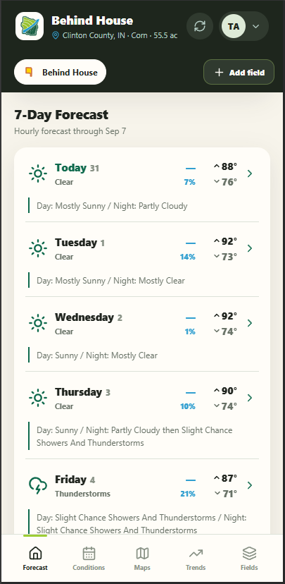
Current conditions, hourly forecasts, weather maps, and the extended outlook remain easy to find. You should not have to navigate through agronomic tools just to check tomorrow’s weather.
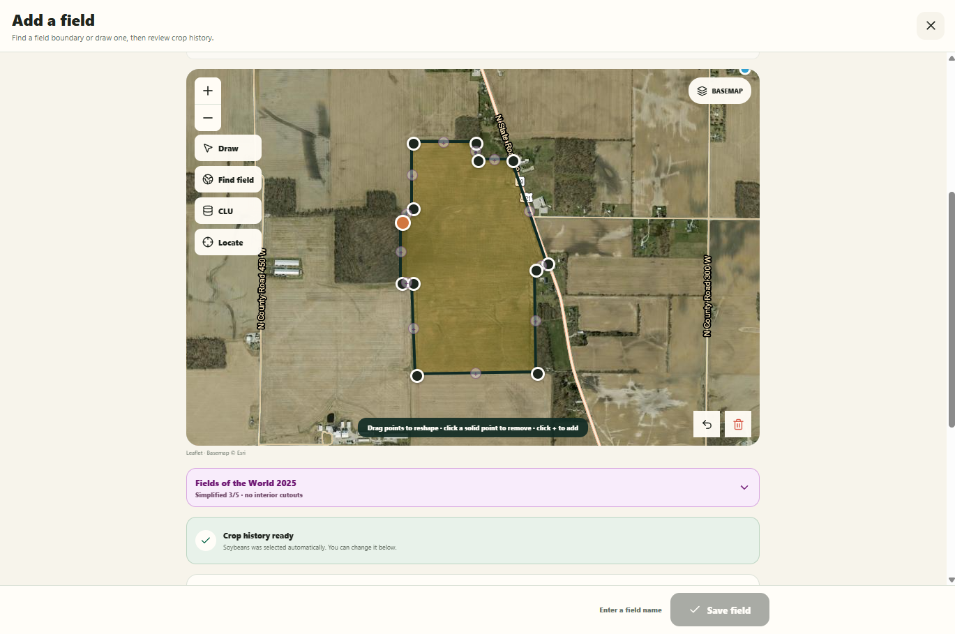
FieldCast organizes weather around actual saved field boundaries, keeping the forecast, maps, seasonal totals, and field conditions connected to the acres where decisions are made.
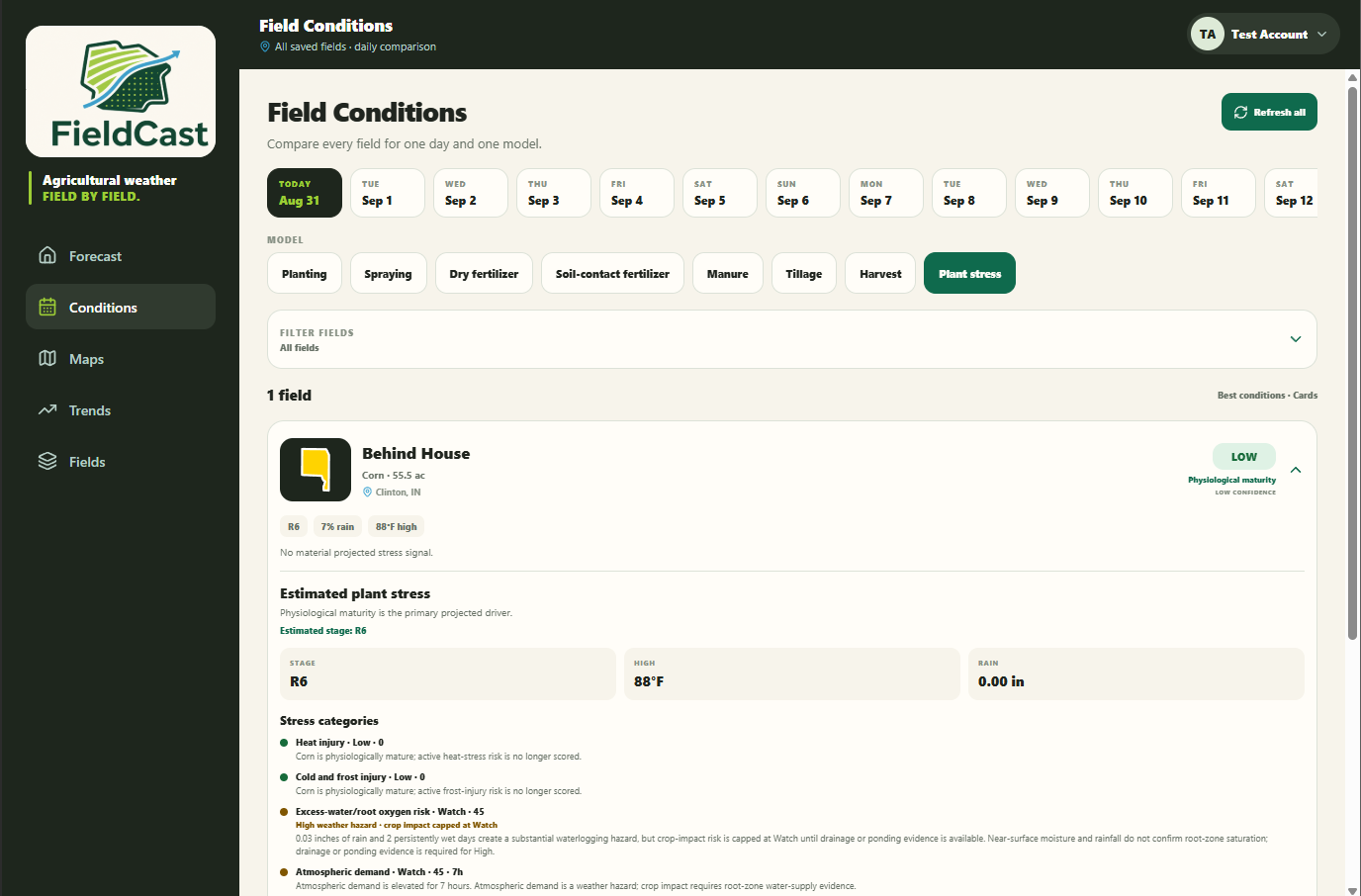
When a decision requires more than a basic forecast, connect weather with soil conditions, crop development, operation windows, seasonal patterns, and field-level trends.
FieldCast does not ask growers to choose between a simple weather app and a field-level agronomic tool. It brings the two together.
Agricultural weather Field by field.
Start on the web today and see what the weather means for the work ahead.